16th June 2021: Selkirk to Hawick – 14 miles
I escaped in to the murk and mizzle at exactly 7am – unlike the plucky soldiers and airmen who escaped from Colditz, I locked up behind myself and posted the keys through the letterbox. I would recommend anyone stopping in Selkirk to either not stop in Selkirk, or at least try and find different accommodation. The bed was OK and the room was clean enough, but they’re the only positive things I have to say about the County Hotel.
Today is my final day and I’m heading for my car, which is parked in Morrison’s car park in Hawick. I checked carefully for parking prohibitions when I left it there, for gates and cameras, but saw none. I also parked it close to the building, but not so close that it would be too obvious. I’ve spent all 5 days with a slight nagging worry in the back of my mind that I will come back to find it impounded, or vandalised, up on bricks, windows smashed in, covered in graffiti – or some similar dreadful fate! As I’m heading to my car I have no schedule to keep to, but I also want to try and maintain my steady pace – I don’t want to blow my knee up now – I have a lot more walking to do this summer.
The CBDR follows the Border Abbeys Way nearly all day today and that walk is very well signed. In fact I didn’t see a single CBDR waymarker today, but there are AW marker posts at almost every change of direction. From Selkirk the path cuts through the Haining estate, gaining height gently, but continually for the first mile or so. The forecast had predicted 40-50% chance of rain all day, with gusting wind and moderate temps, so for the first time this week I set out in my hard shell. You get spoiled with Paramo – the silky smooth inner layer means you can wear anything you like under it – but with a hard shell I feel like I need to wear long sleeves, else I end up sticking to the inside of the coat. So I used my long-sleeve Craghopper shirt under the hard shell and kep my Tilley stowed on my pack all day. The hard shell is waterproof enough, but it’s not breathable and I was soon wetter inside than I would have been if I’d not been wearing it. The day was cold though, so I stuck with it.
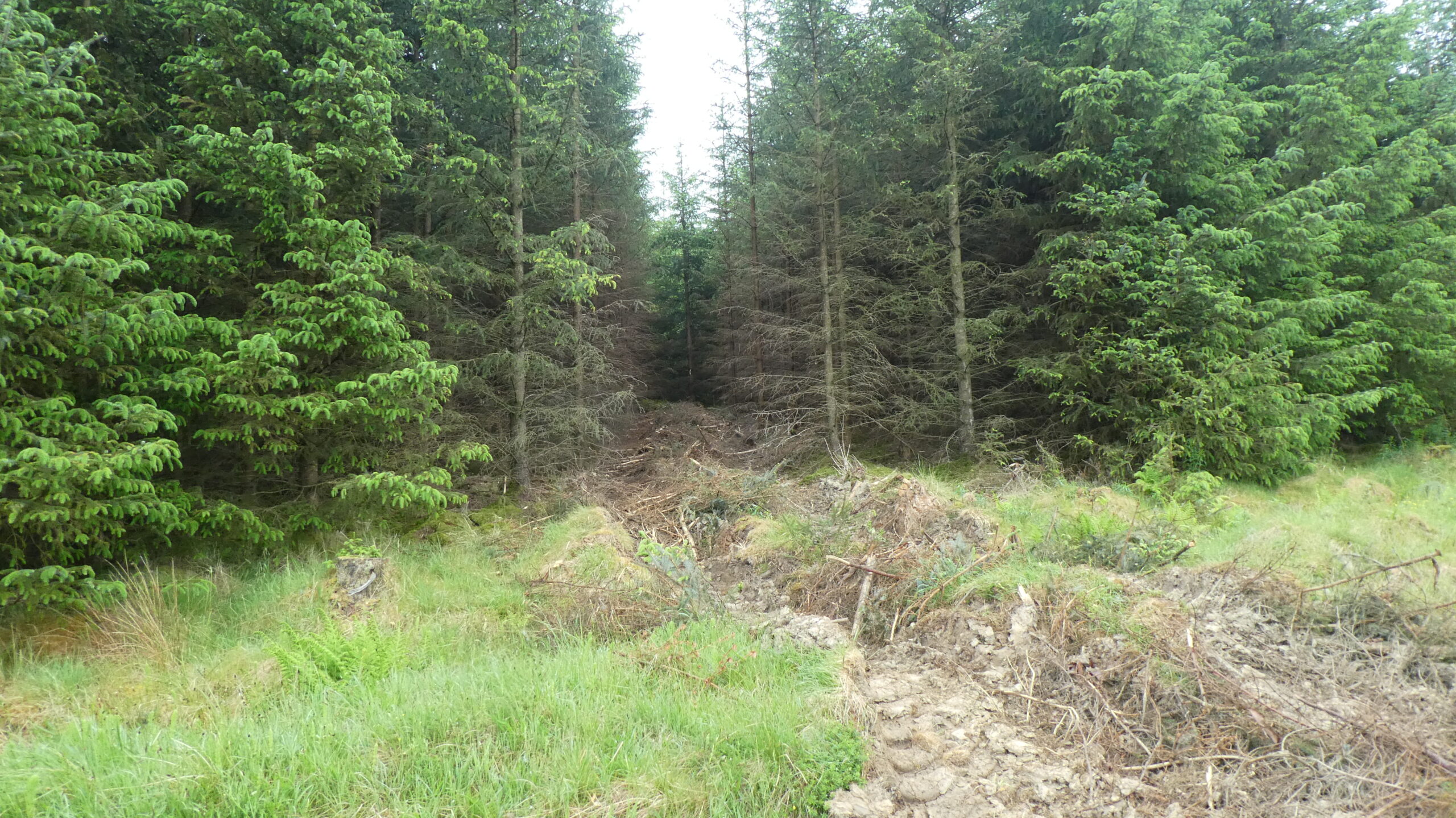
The first couple of miles were mostly fields and pastures, with lots of cows and farm tracks and so many gates I soon lost count. Pretty soon though the path reached the outskirts of the Ettrick Forest and the scenery began to pick up a bit. The long views were mostly obscured by low cloud, but I was soon enjoying green tracks through trees, or beside old felled sections of plantations. I had high hopes for this bit of forest, but it was nothing like as nice as yesterday and for the most part I was on a wide forest road with a thin grass strip down the middle. There has been lots of logging going on, but only to cut thin strips into the wide ranks of trees either side of the path, almost as if they were making dozens of parallel rides through the forest.


All too soon I was out of the forest and onto tarmac for a mile or so – it was a quiet lane at least and it had wide views ahead and trees either side of the road. It was still road though! The highlight of the day was encountered when I finally got off the road and skirted around the top of Woll Burn on the Thief Road – it was absolutely beautiful. A deep glen with a thin burn twisting and turning down its length and the whole glen filled with yellow flowering gorse and dotted with white hawthorn bushes. All too soon this was behind me and I had to dodge my way across a golf course, although it was still quite early and there weren’t many folk out.


Beyond the golf course I entered another lovely section, through Salenside Plantation. The path is narrow, overhung by trees and sheltered. I found a spot to throw my tarp down and have a second breakfast. It was so sheltered there was absolutely no wind, and within a couple of minutes I was being buzzed by midgies. A couple more minutes and their numbers and intensity were enough to force me to move on. For a few minutes I was back on a wide forest road, but much to my delight this soon turned into a firm grassy track that wound in and out of stands of trees, up and over mounds and across a footbridge at Falla Cleuch. It was my second favourite section of the day.


Once out of the trees it was back into sheep pastures again. I shunned the diversion up to a nearby trig point – I was becoming quite focussed on just finishing now and the map showed it on the other side of a field boundary and the potential of a dyke topped with barbed wire put me off. The fields and pastures were fine, the paths were firm and easy to follow and the views were still lovely. I couldn’t help compare today’s route to that of yesterday however and although I was still enjoying it, this was not a patch on that! It felt like a final day (or a first day) where the path designers are having to make the best of a bad deal – trying to reach the end, without using tarmac.


If that had been their goal then they failed. The last 3 miles of today’s route is just that – along a tarmac road and if I’m honest I mostly switched off along it. I could see Hawick a long time before I got close to it and all I could think about now was my car! Would it still be there?
I made reasonable time along the road of course and there hadn’t been that much height gain today, so I’d actually made pretty good time all day. I arrived on the outskirts of Hawick at about 11:30, so I’d averaged about 2.8mph for the day. My knee felt fine, as did my left calf, so I’d managed a reasonable pace and still preserved myself.
As I got close to Morrisons I began to see cars in the car park and searched for mine. I could see roughly where I’d parked it, but couldn’t see it. I have to admit I had a little panic at that time, but when I got closer I could see it was obscured by another vehicle. I checked all round and it was fine – no damage – what a bloody relief! I decided to make a quick getaway and moved to another nearby short-stay car park where I changed out of my wet clothes and into the spares I had left there for just this eventuality.
I had an uneventful, if rather tiring drive home, having to stop a couple of times just to wake myself up. I’m back home now, showered, shaved and feeling pretty good. Normally, after a multi-day walk, my legs feel like they belong to someone else and I can barely walk for a couple of days, but there’s none of that feeling at the moment.
I thoroughly enjoyed the Cross Borders Drove Road – there is a little bit of road walking in places, but this is more than compensated by some fabulous lowland hill walking. The forest sections are mostly excellent – none of the horrendous boggy paths that you find at the western end of the Southern Upland Way, often with trees down over the path, that have been down for ages and no-one is planning on removing. Having said that, the best section of the CBDR is also part of the SUW.
I do not regret missing a huge section of the CBDR path at the end of day 4 and the start of day 5 – I enjoyed my own alternative into Selkirk and the way out of the same town is also fairly good. It’s a shame there are no CBDR markers on the last day – it’s been completely consumed by the Border Abbeys Way and I kind of missed the hit and miss approach to CBDR waymarking that I saw on the first few days.
2 thoughts on “Cross Borders Drove Road – Day 5”
From your pics and descriptions, Stuart, the CBDR certainly looks like a quiet trail – which is right up my street! I definitely plan to tackle this before the summer’s out.
In the 5 days I only saw 3 ‘proper’ walkers (packs, maps, etc.) – plenty of dog walkers and strollers near the towns, quite a few cyclists (mostly on the road sections, but a couple off road on the track) – it’s a very quiet walk and very scenic too. If you want the GPX of my route (with the diversion into Selkirk and the track out of Innerleithen) just let me know, happy to share it. Cheers, Stuart