The Yorkshire Dales Tops – The New Challenge
After an electronic conversation with a fellow Yorkshire Top bagger – who I’d managed to confuse by the rather arbitrary inclusion of some hills in my original list – I decided to put a little bit of science behind the Yorkshire Top list. The result is a completely bespoke list, based on a set of parameters I’ve defined myself, but offering a large number of new hills to be climbed before I can consider it complete. The list is primarily based on the Database of British Hills – a superb reference site and fast becoming my de-facto hill information source.
The boundary I have set for this new hill list is the Yorkshire Dales National Park. This is a much easier boundary to identify than the English county of “Yorkshire” and is not confused by historic county boundaries or irrational hill inclusions based on “it’s always been in Yorkshire” type judgements. This boundary selection does exclude some hills which you would expect to be in there though – Nine Standards Rigg being one and Wild Boar Fell being another.
If a fell lies within about 100 metres of the bounday then it may be included – again my judgement call – and an example of this is Swarth Fell – the summit of which lies about 50 yards outside the National Park boundary, but the vast majority of the fell lies within it. Many of the northern Howgill Fells also fall outside the boundary – so don’t expect to find Yarlside or Randygill Top in this list.
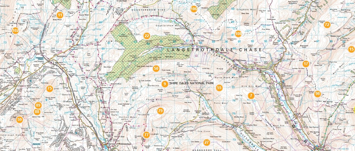
Interactive Map
Click the map below to go to an interactive map of the Dales Tops. This uses Bing Maps and opens in a new window
Yorkshire Dales, All Tops – Ascent Table
| No. | Hill Name | Hill Classes | Height | First Ascent | No. Asc |
|---|---|---|---|---|---|
| 1 | Abbot Hills | 4 | 1362 ft, 415.00 m | 0 | |
| 2 | Addlebrough | 4,sHu | 1578 ft, 481.00 m | 28/05/2016 | 1 |
| 3 | Arant Haw | Sim,5 | 1985 ft, 605.00 m | 13/08/2011 | 1 |
| 4 | Archy Styrigg [Gregory Chapel] | N,sSim | 2280 ft, 695.00 m | 24/04/2010 | 3 |
| 5 | Ash Fell | 3 | 1263 ft, 385.00 m | 29/07/2016 | 1 |
| 6 | Aye Gill Pike | Ma,5 | 1824 ft, 556.00 m | 27/06/2009 | 1 |
| 7 | Barbon Low Fell | Hu,4 | 1437 ft, 438.00 m | 0 | |
| 8 | Baugh Fell - Tarn Rigg Hill | Ma,Sim,Hew,N | 2224 ft, 678.00 m | 17/04/2010 | 1 |
| 9 | Beacon Hill | 3 | 1286 ft, 392.00 m | 30/05/2009 | 2 |
| 10 | Birkett Common | 3 | 1155 ft, 352.00 m | 0 | |
| 11 | Birks Fell | Ma,Sim,Hew,N | 2001 ft, 610.00 m | 21/01/2012 | 1 |
| 12 | Black Hill | 4 | 1535 ft, 468.00 m | 0 | |
| 13 | Blaydike Moss | 5 | 1673 ft, 510.00 m | 10/07/2010 | 1 |
| 14 | Blea Barf | s5 | 1778 ft, 542.00 m | 0 | |
| 15 | Blea Moor | Hu,5 | 1755 ft, 535.00 m | 27/01/2007 | 2 |
| 16 | Blease Fell | 4 | 1555 ft, 474.00 m | 0 | |
| 17 | Bluecaster | 3 | 1132 ft, 345.00 m | 30/07/2016 | 1 |
| 18 | Bram Rigg Top | N | 2205 ft, 672.00 m | 22/08/2009 | 1 |
| 19 | Brown Bank | 4 | 1427 ft, 435.00 m | 01/09/2015 | 1 |
| 20 | Brown Haw | 5 | 1916 ft, 584.00 m | 27/05/2016 | 1 |
| 21 | Brown Moor | 4 | 1352 ft, 412.00 m | 0 | |
| 22 | Buckden Pike | Ma,Sim,Hew,N | 2303 ft, 702.00 m | 15/08/2006 | 5 |
| 23 | Bush Howe | N | 2044 ft, 623.00 m | 22/08/2009 | 2 |
| 24 | Calders | Sim,Hew,N | 2216 ft, 675.40 m | 04/10/2008 | 3 |
| 25 | Calf Top | Ma,Sim,Hew,N | 2000 ft, 609.60 m | 05/01/2008 | 1 |
| 26 | Calver Hill [Reeth Low Moor] | 4,sHu | 1598 ft, 487.00 m | 16/06/2012 | 1 |
| 27 | Cam Rakes [Oughtershaw Common] [Cocklee Fell] | Hu,5 | 1650 ft, 503.00 m | 20/02/2010 | 1 |
| 28 | Castle Knott | 5 | 1765 ft, 538.00 m | 05/01/2008 | 1 |
| 29 | Clapham High Mark | s5 | 1729 ft, 527.00 m | 06/04/2012 | 1 |
| 30 | Cleasby Hill | s5 | 1677 ft, 511.00 m | 0 | |
| 31 | Cracoe Fell | Ma,5 | 1666 ft, 507.80 m | 27/03/2010 | 2 |
| 32 | Crier Hill | 1 | 545 ft, 166.00 m | 0 | |
| 33 | Darnbrook Fell | Sim,Hew,N | 2047 ft, 624.00 m | 08/11/2008 | 1 |
| 34 | Docker Knott | s5 | 1739 ft, 530.00 m | 01/06/2013 | 1 |
| 35 | Dodd Fell Hill | Ma,Sim,Hew,N | 2192 ft, 668.00 m | 18/07/2009 | 2 |
| 36 | Drumaldrace | Sim,Hew,N | 2014 ft, 614.00 m | 18/07/2009 | 1 |
| 37 | Elbolton | 3 | 1142 ft, 348.00 m | 0 | |
| 38 | Feizor Thwaite | 3 | 1099 ft, 335.00 m | 0 | |
| 39 | Fell Head | 3 | 991 ft, 302.00 m | 0 | |
| 40 | Fell Head | Sim,Hew,N | 2099 ft, 639.90 m | 22/08/2009 | 4 |
| 41 | Flasby Fell | 2 | 928 ft, 283.00 m | 0 | |
| 42 | Fountains Fell South Top | Ma,Sim,Hew,N | 2192 ft, 668.00 m | 08/11/2008 | 2 |
| 43 | Fountains Fell | N | 2172 ft, 662.00 m | 27/02/2010 | 2 |
| 44 | Gragareth | Sim,Hew,N,CoU,CoA | 2060 ft, 628.00 m | 05/07/2008 | 2 |
| 45 | Great Close Hill | 4 | 1526 ft, 465.00 m | 25/07/2015 | 1 |
| 46 | Great Coum | Ma,Sim,Hew,N | 2254 ft, 687.00 m | 05/07/2008 | 2 |
| 47 | Great Knoutberry Hill | Ma,Sim,Hew,N | 2205 ft, 672.00 m | 13/02/2010 | 2 |
| 48 | Great Pinseat | 5 | 1913 ft, 583.00 m | 21/08/2010 | 1 |
| 49 | Great Shunner Fell | Ma,Sim,Hew,N | 2349 ft, 716.00 m | 07/09/2005 | 9 |
| 50 | Great Whernside | Ma,Sim,Hew,N | 2310 ft, 704.00 m | 15/08/2006 | 2 |
| 51 | Green Bell | Sim,5 | 1985 ft, 605.00 m | 07/02/2009 | 2 |
| 52 | Green Hill | N,sSim | 2059 ft, 627.50 m | 05/07/2008 | 2 |
| 53 | Green Park Hill | 2 | 807 ft, 246.00 m | 0 | |
| 54 | Grizedales | Hu,5 | 1814 ft, 553.00 m | 07/08/2010 | 1 |
| 55 | Hand Lake | 4 | 1639 ft, 499.60 m | 10/03/2012 | 1 |
| 56 | Harland Hill | 5 | 1755 ft, 535.00 m | 26/03/2011 | 2 |
| 57 | Harter Fell | Hu,5 | 1709 ft, 521.00 m | 31/03/2012 | 1 |
| 58 | Hazelgill Knott | 5 | 1896 ft, 578.00 m | 25/02/2012 | 2 |
| 59 | Height of Hazely | Hu,5 | 1814 ft, 553.00 m | 26/03/2011 | 1 |
| 60 | Hellifield Haw | 2 | 712 ft, 217.00 m | 0 | |
| 61 | Helms Knott | 3 | 994 ft, 303.00 m | 0 | |
| 62 | High Crag | 4 | 1378 ft, 420.00 m | 0 | |
| 63 | High Crag | 3 | 1171 ft, 357.00 m | 27/03/2010 | 2 |
| 64 | High Green Field Knott | Sim,5 | 1979 ft, 603.20 m | 10/07/2010 | 1 |
| 65 | High Hill | 3 | 1306 ft, 398.00 m | 0 | |
| 66 | High Pike | s5 | 1762 ft, 537.00 m | 0 | |
| 67 | High Seat | Hu,Sim,Hew,N | 2326 ft, 709.00 m | 24/04/2010 | 3 |
| 68 | Hoggs Hill | 4 | 1411 ft, 430.00 m | 0 | |
| 69 | Holme Knott | 3 | 1214 ft, 370.00 m | 0 | |
| 70 | Hooksey | 5 | 1923 ft, 586.00 m | 25/05/2013 | 1 |
| 71 | Hoove | Ma,5 | 1820 ft, 554.60 m | 30/07/2011 | 1 |
| 72 | Horrows Hill | 2 | 679 ft, 207.00 m | 0 | |
| 73 | Horse Head Moor | Sim,5 | 1999 ft, 609.30 m | 06/04/2007 | 2 |
| 74 | Hugh Seat | N,sSim | 2260 ft, 689.00 m | 24/04/2010 | 4 |
| 75 | Hunter Bark | 3 | 1047 ft, 319.00 m | 03/04/2010 | 1 |
| 76 | Hutton's Monument | 3 | 994 ft, 303.00 m | 0 | |
| 77 | Ingleborough | Ma,Sim,Hew,N | 2375 ft, 724.00 m | 08/12/2007 | 9 |
| 78 | Kail Hill | 3 | 994 ft, 303.00 m | 0 | |
| 79 | Kelleth Rigg | 3 | 1043 ft, 318.00 m | 0 | |
| 80 | Kensgriff | 5 | 1883 ft, 574.00 m | 07/02/2009 | 3 |
| 81 | Kirkby Fell | 5 | 1793 ft, 546.40 m | 19/11/2011 | 1 |
| 82 | Kisdon | Ma,4 | 1636 ft, 498.60 m | 10/09/2011 | 1 |
| 83 | Knott | Hu,4 | 1352 ft, 412.00 m | 30/05/2009 | 1 |
| 84 | Knotts | 3 | 1001 ft, 305.00 m | 0 | |
| 85 | Knoutberry Haw | N,sSim | 2218 ft, 676.00 m | 17/04/2010 | 1 |
| 86 | Langdale Knott | 4 | 1565 ft, 477.00 m | 0 | |
| 87 | Langerton Hill | 2 | 912 ft, 278.00 m | 02/01/2012 | 1 |
| 88 | Linghaw | 4 | 1636 ft, 498.80 m | 13/08/2011 | 3 |
| 89 | Little Asby Scar | 3 | 1168 ft, 356.00 m | 0 | |
| 90 | Little Fell | Sim,Hew,N | 2188 ft, 667.00 m | 24/04/2010 | 2 |
| 91 | Little Fell | s5 | 1834 ft, 559.00 m | 06/04/2013 | 1 |
| 92 | Long Scar Pike [Coalpit Hill] | 4 | 1316 ft, 401.00 m | 0 | |
| 93 | Lovely Seat | Hu,Sim,Hew,N,sMa | 2214 ft, 674.70 m | 17/07/2010 | 1 |
| 94 | Malham Moor | 4 | 1348 ft, 411.00 m | 0 | |
| 95 | Melbecks Moor | s5 | 1896 ft, 578.00 m | 0 | |
| 96 | Moughton | 4 | 1401 ft, 427.00 m | 16/12/2006 | 2 |
| 97 | Naughtberry Hill | 5 | 1880 ft, 573.00 m | 06/07/2013 | 2 |
| 98 | Nettle Hill | Hu,3 | 1253 ft, 382.00 m | 23/07/2016 | 1 |
| 99 | Newton Moor Top | 2 | 955 ft, 291.00 m | 03/04/2010 | 1 |
| 100 | Oxnop Common - Blackstone | 5 | 1916 ft, 584.00 m | 14/10/2010 | 1 |
| 101 | Park Fell | 5 | 1847 ft, 563.00 m | 14/02/2009 | 3 |
| 102 | Parson's Pulpit | Hu,5 | 1765 ft, 538.00 m | 27/11/2010 | 2 |
| 103 | Pen-y-ghent | Ma,Sim,Hew,N | 2277 ft, 694.00 m | 27/08/2006 | 6 |
| 104 | Pickerstone Ridge | 5 | 1854 ft, 565.00 m | 12/06/2010 | 1 |
| 105 | Plover Hill | Sim,Hew,N | 2231 ft, 679.90 m | 05/06/2010 | 3 |
| 106 | Proctor High Mark | 5 | 1742 ft, 531.00 m | 27/11/2010 | 2 |
| 107 | Randygill Top | Hu,Sim,Hew,N | 2047 ft, 624.00 m | 25/07/2009 | 2 |
| 108 | Redshaw Moss [Snaizeholme Fell] | 5 | 1788 ft, 545.00 m | 24/08/2011 | 1 |
| 109 | Robert's Seat | s5 | 1801 ft, 549.00 m | 0 | |
| 110 | Rogan's Seat | Ma,Sim,Hew,N | 2205 ft, 672.00 m | 05/09/2009 | 1 |
| 111 | Rough Haw | 3 | 1112 ft, 339.00 m | 0 | |
| 112 | Rye Loaf Hill | 5 | 1795 ft, 547.00 m | 03/04/2010 | 1 |
| 113 | Sails | O | 2185 ft, 666.00 m | 24/04/2010 | 1 |
| 114 | Sharp Haw | Ma,3 | 1171 ft, 357.00 m | 22/09/2011 | 1 |
| 115 | Shawrigg Hill | 2 | 771 ft, 235.00 m | 0 | |
| 116 | Simon Fell North Top | Sim,Hew,N | 2133 ft, 650.00 m | 14/02/2009 | 2 |
| 117 | Simon Fell | Un | 2054 ft, 626.00 m | 14/02/2009 | 2 |
| 118 | Simon's Seat | Hu,4 | 1591 ft, 485.00 m | 23/10/2010 | 1 |
| 119 | Simon's Seat | 5 | 1926 ft, 587.00 m | 10/03/2012 | 1 |
| 120 | Smearsett Scar | Hu,3 | 1191 ft, 363.00 m | 26/08/2006 | 3 |
| 121 | Stony Band | Un | 1959 ft, 597.00 m | 02/06/2018 | 1 |
| 122 | Swarth Fell Pike | Sim,Hew,N | 2234 ft, 681.00 m | 30/08/2009 | 3 |
| 123 | Swarth Fell | xN | 2136 ft, 651.00 m | 03/07/2011 | 2 |
| 124 | Talebrigg Hill | 2 | 787 ft, 240.00 m | 0 | |
| 125 | Tarn Seat [Conny Tammy Currack] [The Fleak] | 5 | 1808 ft, 551.00 m | 14/10/2010 | 1 |
| 126 | Terry Bank | 2 | 666 ft, 203.00 m | 0 | |
| 127 | The Calf | Ma,Sim,Hew,N | 2218 ft, 676.00 m | 04/10/2008 | 4 |
| 128 | The Old Pike | 4 | 1312 ft, 400.00 m | 27/12/2011 | 1 |
| 129 | Thorpe Fell Top | s5 | 1660 ft, 506.00 m | 27/03/2010 | 2 |
| 130 | Three Mile Hill | 2 | 676 ft, 206.00 m | 0 | |
| 131 | Thwaite Scars | 4 | 1339 ft, 408.00 m | 0 | |
| 132 | Tor Mere Top | xN | 2060 ft, 628.00 m | 15/08/2006 | 3 |
| 133 | Uldale Head | Hu,5 | 1745 ft, 532.00 m | 10/03/2012 | 1 |
| 134 | Wandale Hill | Hu,4 | 1631 ft, 497.00 m | 31/03/2012 | 1 |
| 135 | Warrendale Knotts | 4 | 1444 ft, 440.00 m | 06/03/2008 | 1 |
| 136 | Water Crag | N,sSim | 2192 ft, 668.00 m | 05/09/2009 | 1 |
| 137 | Weets Top | 4 | 1358 ft, 414.00 m | 06/03/2010 | 2 |
| 138 | West Fell | 5 | 1778 ft, 542.00 m | 25/02/2012 | 2 |
| 139 | Whernside | Ma,Sim,Hew,N,CoH,CoU,CoA | 2415 ft, 736.00 m | 17/11/2007 | 8 |
| 140 | White Mossy Hill | xN | 2162 ft, 659.00 m | 05/05/2006 | 4 |
| 141 | Wild Boar Fell East Top | Ma,Sim,Hew,N | 2323 ft, 708.00 m | 30/08/2009 | 4 |
| 142 | Wild Boar Fell | Un | 2320 ft, 707.00 m | 30/08/2009 | 3 |
| 143 | Winder | 4 | 1552 ft, 473.00 m | 04/10/2008 | 3 |
| 144 | Wold Fell | 5 | 1834 ft, 559.00 m | 28/08/2010 | 2 |
| 145 | Woldside | 5 | 1955 ft, 596.00 m | 30/05/2015 | 1 |
| 146 | Woodhall Greets | Un | 1759 ft, 536.00 m | 0 | |
| 147 | Yarlside | Ma,Sim,Hew,N | 2096 ft, 639.00 m | 25/07/2009 | 2 |
| 148 | Yockenthwaite Moor | Sim,Hew,N | 2110 ft, 643.00 m | 26/06/2010 | 2 |
1 thought on “Yorkshire Dales Tops”
Amazing to accomplish all these walks!