
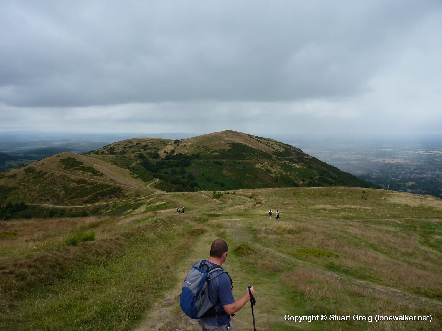
Today, for the first time, I was walking with Alex, a friend from work - he's in training for Kilimanjaro in January and he lives in the flat and boring southlands, so we met somewhere central for some hills. Finding 10-12 miles of strenuous hill walking in the Midlands is difficult. One of the very few options is the Malvern Hills. Fortunately with two cars it's possible to do the full length in about 4-5 hours; depending on how long you stop at the ice cream cabin on the A449.
The Malvern Hills are a series of ups and downs - there is no ridgeline as such, but it was a reasonable workout for Alex and it was a good test for my knees, which have been troublesome of late. As it was we both coped admirably and had a great time. We had almost perfect summer walking weather too - no direct sunshine, but warm and a slight breeze to keep us cool.
Date: 2010-07-24
Start: Midsummer Hill Finish: North Malvern
Distance: 9.0 mls, 14.48 km
Height Gain: 2600 ft, 792.5 m
Start Time: 09:10 End Time: 13:09
Duration: 03:59
Ave Speed: 2.3 mph
Region: Midlands
Route Description: Westfields, Hangman's Hill, Herefordshire Beacon, Upper Wyche, Worcestershire Beacon, Lady Howard de Walden Drive, North Quarry car park at Great Malvern
Parking Grid Ref: SO 75880 36872
View Parking space in: OS Map or Google Street View
Walking with: Alex Watson
Long Distance Path:
2854 - Worcestershire Beacon (1394 ft)
5364 - Herefordshire Beacon (1109 ft)
16995 - Pinnacle Hill (1171 ft)
17056 - Swinyard Hill (892 ft)
TP0724 - Malvern (Good condition)
Click any image to open the full screen photo gallery


Walk Name: Lovely Seat
Date: 2010-07-17
Distance: 8.0 mls, 12.87 km
Height Gain: 1600 ft, 487.7 m
Walk Name: Snake Pass Traverse
Date: 2010-07-31
Distance: 14.0 mls, 22.53 km
Height Gain: 3100 ft, 944.9 m