What is the Southern Upland Way?
The Southern Upland Way is the only official Coast to Coast path in the UK, it’s also Scotland’s longest official path at 212 miles, although this title may be lost if Cameron McNeish’s “Scottish National Trail” actually becomes a National Trail in the future.
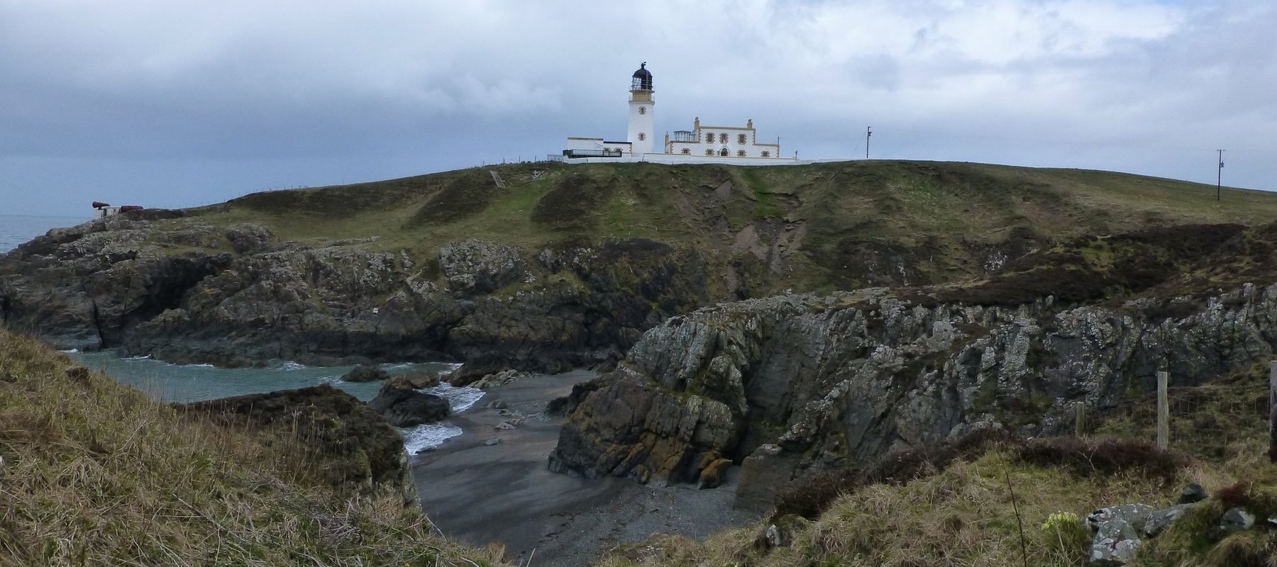
The west coast starting point of the Southern Upland Way is in the tiny fishing village of Portpatrick, on the hammer-head peninsula called The Rhins, in the south west corner of Scotland. The path then crosses two counties; Dumfries & Galloway and the Scottish Borders to arrive in the village of Cockburnspath on the east coast.
Technically the path isn’t a Coast to Coast walk as Cockburnspath isn’t on the coast, it’s actually 1/2 a mile or so inland from the coast and the path, for some unknown reason, doesn’t officially touch the east coast at all. There is a diversion however, taken by nearly everyone that walks the route, down to Cove Harbour, where a walker can allow the North Sea to caress his boots and where he may toss his pebble, dutifully carried from the Irish Sea in the west.

I get the impression that the 212 miles of path has scenery similar to the Pennine Way; crossing rolling hills rather than high mountain passes and with vistas down into valleys and across rounded humps rather than up to rocky heights and snow-capped peaks. That’s not a problem for me though, as I loved the Pennine Way and rolling hills abound in the Howgills, where I also enjoy walking.
On the downside, there does appear to be a fair amount of road walking involved and a disconcerting number of forests to walk through. This makes me think back to the West Highland Way and Great Glen Way, which I walked in 2008. The former was almost completely on hard packed surfaces, either cobbles, tarmac or flint-type surfaces and the latter was mostly through forests with very restricted views, on gravel tracks.
Having looked at the route on the map, I’m not expecting too much in the way of grand views and high moors from the first two or three days and indeed from the last couple of days either. However, the middle section looks splendid; desolate moorland interspersed with forests and the occasional loch side path.
The Approach
The Southern Upland Way (SUW) should prove almost as challenging as the Pennine Way, it’s a couple of dozen miles shorter, more remote in places (if that is possible) and probably just as quiet if the lack of personal journals on the Internet is anything to go by.
The SUW was originally part of my “Perfect LEJOG” route, but since I had to pare that route back to meet the constraints of reality, the SUW must now be completed in its own right. 2013 seems like the perfect time to do it.
I’ll be carrying all my own gear, for the first time since 2007 on the aborted Offa’s Dyke. There are two reasons for this; a) the baggage courier service costs about £350 and b) I need to train for the LEJOG in 2014 when I’ll have no choice but to carry all my gear. The SUW seems like a good place to test the kit load and look for ways to improve on it.
I won’t be backpacking it though, the route is too long to experiment with that part of the LEJOG planning, so I’ll be finding other ways to hone my skills in that area.