I walked the Affric Kintail Way over three days in late March, with my most excellent friend Chris (@PilgrimChris on Twitter and www.pilgrimchris.com). I’ve already posted some information on the walk itself and I’ve done a kit list and a review of the kit I used in other posts too, so this text is about the walk itself.
Getting to the start of the walk was a good 8-hour journey for us, so we drove up after work on the Tuesday, stopping around midnight in a quiet car park outside Perth for an overnight car camp to break it up. Using Google Maps, I’d found a lovely secluded spot, off the main A9, and we parked next to a camper van who’d had the same idea. We were away early in the morning, leaving plenty of time to cover the remaining distance and get a good breakfast on the way. We arrived in Drumnadrochit in plenty of time and kicked around the Information Centre car park waiting for our taxi. The car park is free and has plenty of ‘No Overnight Parking’ signs, but we had no problem and there were loads of empty spaces. Our taxi arrived on time and our friendly driver, Caroline, transported us smoothly to the start of our walk. She’s driven quite a few AKW walkers since the route opened last year and if you need a lift to or from the walk, she is probably the best bet unless you happen to fall in with the bus schedule. Give her a call on 07721 055944.
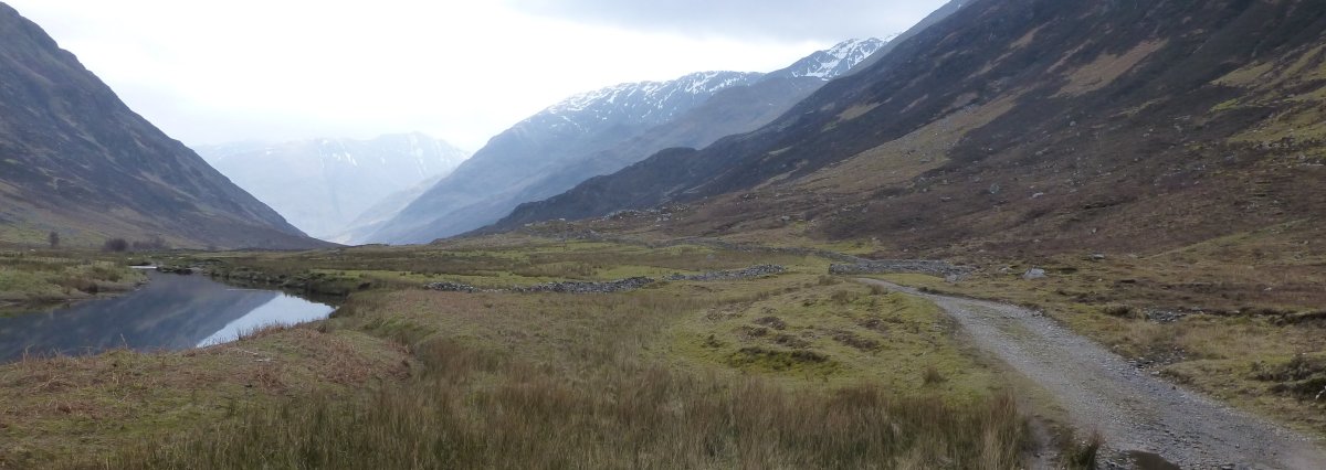
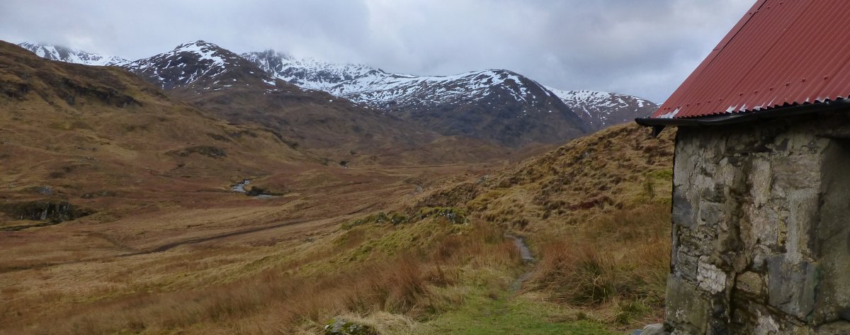
It was quite warm as we set off down the long, wide valley of Glen Lichd, beside the slow River Croe and beneath the looming presence of the Five Sisters of Kintail. The mountains were sprinkled with snow and mist hung just above their peaks, but there was some blue sky between the clouds and we were hopeful about the weather for the rest of the day (if not the rest of the walk). The first four miles or so were along the wide, flat Land Rover track, the river beside us was still and glass-like and we revelled in the unexpected warmth. At the head of the valley, as we approached Glenlicht House, the weather began to turn; the blue sky was snuffed out and grey, ominous clouds rolled in over the tops.
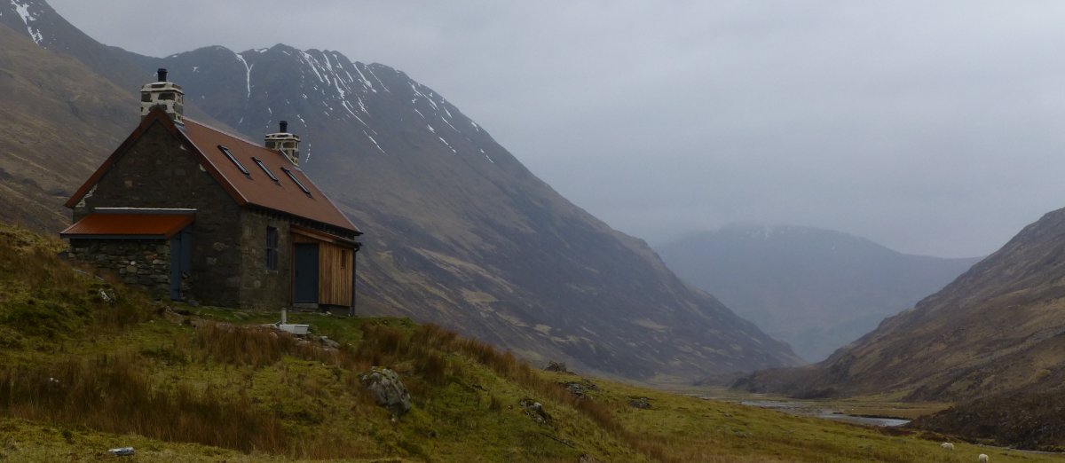
Glenlicht House is a locked bothy operated by Edinburgh University Mountaineering Club, but it’s also available for hire and, as we could make out a vehicle beside it, we were hoping someone would be in, so we could stop for a brew. It was locked unfortunately and a peek through the window showed it had been very recently renovated, with a new floor and lots of roof work. There was no sign of the Land Rover’s owner, and we found an abandoned push bike leaning against the building, so we figured people were working nearby, or had walked in to the bothy at Camban – our next stop. It began to rain at this point, so we donned waterproofs and began the long steady climb away from the house.
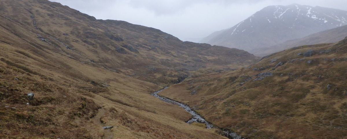
The next four miles of path are truly fantastic! It’s a rugged little track that hugs the side of the hill above the Allt Grannda. It twists and turns, opening new views each time with hills all around us. The rain was gentle but persistent and didn’t really damped our mood. We met another walker, coming down the path towards us and we stopped to chat for a minute – he’d completed some of the surrounding Munros and was heading back to the bike we’d seen at Glenlicht House. He reported strong winds, sleet and snow on the high tops and was glad to be down into the relative warmth of the valley. We said our goodbyes and carried on.
I don’t have many good shots of this section, it was raining too hard for my camera and the phone was in its Aquapac so the photos are a bit crap.

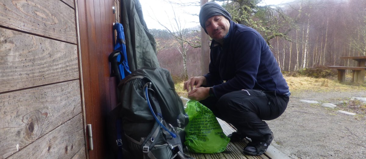
We soon arrived at Camban bothy and although there was no firewood, we did our best to dry our wet gear by hanging it on every available surface, hook and line. We put some music on and brewed an almost endless stream of tea and coffee to keep warm. The rain came and went and I was able to go and fetch more water without getting too damp, before we settled down on the long, wide sleeping platform, chatting and drinking. I was soon asleep and slept really well, despite the wind and rain getting up in the night.

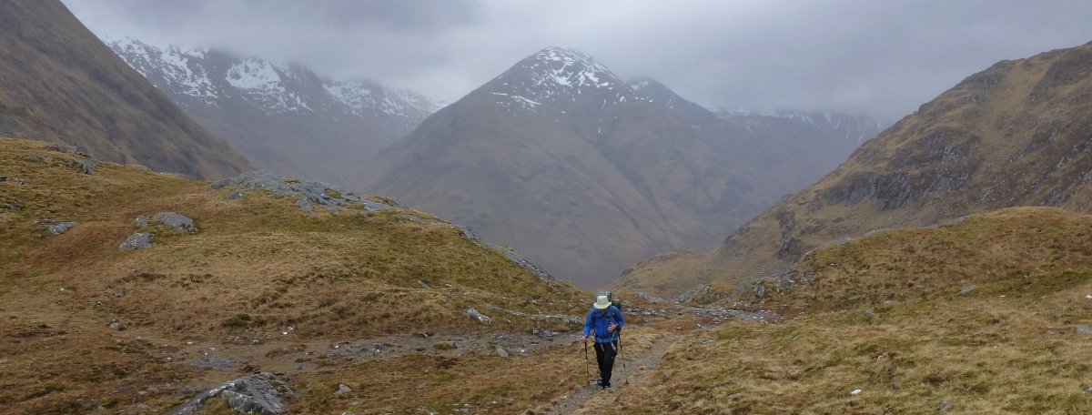
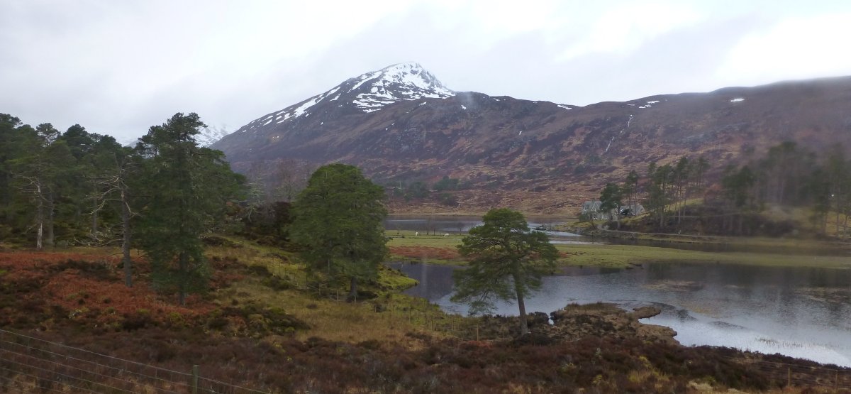
The next morning the weather was no better and we reluctantly donned wet gear and shuffled out into the drizzle. The path from the bothy continued to be fantastic, with the surrounding hills still snow-topped for the most part, with many sporting newly refreshed snowy mantles from the weather during the night. A couple of miles after leaving the bothy we reached the remote SYHA hostel at Alltbeithe, still closed for the winter, but set in one of the most fantastic locations of any hostel in the country. I imagine it would make a great base of operations for a long summer weekend exploring the surrounding hills.
After a while we found a nice sheltered spot, beside a burn, out of the weather and set up for a brew. As we were drinking and chatting a rather bedraggled young Japanese lad passed out spot, from the direction we’d just come, without seeing us. We called out to him and he started visibly and then wandered over. We asked him where he’d been and he said he’d been camped behind the hostel – obviously well camouflaged because we’d not seen him when we passed. He was looking for a route, south to the A87 and Glen Cluanie and didn’t like the bogs he found when he tried the obvious route through An Caorann Mor so was looking for another route. We wished him well and he headed off.
I loved this section of the route, all the way up to the buildings at Athnamulloch, at the western end of Loch Affric. Here we left the rugged, wild track and joined a Land Rover track, for the next several miles! By this time the rain had set up a regular pattern of raining and stopping, raining and stopping. This wasn’t an issue for me, I was in my Paramo jacket and waterproof trousers, so when it rained I put my hood up and when it stopped I push it back. It was torture for Chris though. He was using my poncho as an experiment and it was too warm and uncomfortable to use when it wasn’t raining, so every time the rain stopped, so did Chris and wrestled with the poncho, only to have to wrestle it back on again a few minutes later. We must have gone through this process at least a dozen times by the end of the day. He wasn’t a happy bunny.


The Land Rover track seemed to never end, it was hard on the feet and the views were often obscured by trees close to the path. We got glimpses of Glen Affric on occasions and it looked fantastic, even though it was hunched beneath the brooding clouds. We found shelter from the persistent rain at a car park, under the awning of a toilet block – sounds dreadful, but it was dry and sheltered and we were glad of it! The toilets were closed for the winter still, but we made a brew and sat in the dry and encouraged the chaffinches.
The path didn’t improve for the rest of the day, but the weather eventually did. All along the length of Loch Beinn a’ Mheadhoin we were looking out for a suitable camp spot. We found a couple right beside the road, but kept looking until we eventually found a great spot, large enough for both tents and down off the side of the road, beside the loch. It has been used many times before, but wasn’t too badly abused. The location is NH 26453 26843 for reference.

We tried to get a fire going in the well used fire pit, but everything was soaked from the incessant rain and we eventually gave up and settled for another cold camp. I slept well again and the distance between the tents meant that I never heard Chris snoring at all!
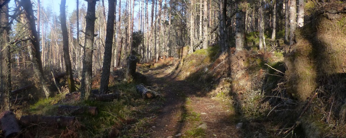
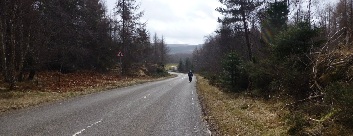
The following morning the weather appeared to have turned and we saw glimpses of blue sky through the trees. We made an early start, resolving to finish the rest of the walk today, all 20 miles of it. The dreaded Land Rover track continued for another couple of miles, as far as the car park and toilets (open this time) at Dog Falls, where it headed higher into the forest. Initially this was on a lovely wooded path, but soon this became a hard-packed forestry road. At least the sun was out though and we were happier because of it.


The forestry road took us the 5 miles or so to Cannich where we were pleased to find the Spar shop open and we sat with bread rolls and chocolate biscuits and brewed up on their picnic benches. We had no idea what was waiting for us! The AKW out of Cannich is along the road and on the map it didn’t look too daunting, but it was awful. Easily the worst part of the whole Way and ruined the walk for me, in more ways than one. The road is busy and the climb seems interminable and the views are non-existent. I hated all four miles of it. By the end of the tarmac I had two cracking blisters, from a combination of wet socks, hard surface and pushing too hard.
We left the road eventually and passed through the little settlement of Shenval and onto more forestry roads. The views at least were a bit better, thanks to a higher elevation and a good deal of forestry activity with many large sections of felled trees. As we sat for a breather, on a sunny bank beside the track, we were questioned by a policeman in a 4×4, looking for a missing hiker, last seen several days ago. We saw a couple of 4WD police vehicles over the next couple of hours as we approached Drumnadrochit and I still don’t know whether they found the guy.


The final mile or two of the path, once we left the forestry track behind, were actually quite good. The path meanders through the forest on footpaths, with generations of pine needles beneath your boots, the only downside being the complete lack of any view other than the trees. We got back to the car around 4pm, having done 21 miles for the day, in about 9 hours. My feet were ruined.
I wasn’t overly impressed with the Affric Kintail Way if I’m honest. I loved the first bit through Kintail and the western end of Glen Affric, but that’s only about 15 miles of the 45 mile walk. In hindsight, the best way to walk it is East to West, so you walk towards the best bit, but even if we’d done it this way I don’t think it would have rescued the walk for me. I’m glad I did it, but I won’t be doing it again.
10 thoughts on “Walking the Affric Kintail Way”
Thanks for sharing this Stuart. I’ve read it before but it was a while ago. Since then I’ve done the AKW twice, once E to W with my wife and once W to E solo on TGOC. I enjoyed it both times but would concur the E to W probably shades it as you walk to the best scenery on the final day (although more likely into the prevailing wind). I understand moves are now afoot to take the stretch from Cannich towards Drumnadrochit off the road which will undoubtedly improve the route. Just a word of caution for any future readers of this blog who may be tempted to walk the north side of Loch Affric as an alternative to the ‘official’ south side. I understand there is one burn on the north side which is very problematic if it’s in spate. I was fortunate on both occasions to find Alltbeithe YH open and the warden, Hanne, is extremely helpful and does great tea, scones and snacks.
Cheers
Paul
Thanks Paul, really useful info about the alternative route
I did like the trail myself. But the first day between Drumnadrochit en Cannich shouldn’t be a part of the trail in my opinion.You can find my report over here http://www.caersbart.be/hiking-the-affric-kintail-way-scotland/
@Darren and Stuart – in this instance the weather didn’t really have a negative effect on me – it would have been better in sunshine, but I was more put off by the track surface in most cases and the disappointing views (or rather the lack of any views at all) once you left the open space of Kintail behind. As James says, E-W is best and we made a mistake there – but he walked it the right way and was still disappointed!
I guess the moral here is that you can have the best scenery in the world, but if the path you pick though it lacks imagination and innovation then you still have a dull plod through the trees. I didn’t need to drive 800 miles to do that. I wish we’d stayed longer, done this walk first, then gone on to do something else.
Stuart, I’m surprised (and disappointed) that the route fell short of your expectations – especially as it took you so long to get there and back. Perhaps the preparation/build-up and the weight of anticipation were a little too much? The weather, too – no one liked to spend most of the day cooped up in restricting waterproofs.
I say ‘disappointed’ above, as the AKW is certainly on my list. I had fully expected to see a write-up full of gushing adjectives, considering the area it passes through. Ah, well. I’ll keep it on my list anyway. Here’s hoping you don’t have a similar experience with the Cape Wrath.
see above
As previously discussed on Twitter East-West is best but it still does not rescue the trail from being overly boring using too many non de-script forestry tracks and the 4-5 miles on tarmac are a deal breaker for me too.
see above
Sorry to hear it didn’t live upto expectations, though I’m sure the weather made staying positive a hard task…the rain must have been depressing it seemed relentless.
see above