I should have been walking along the Pennine Way with @PilgrimChris this weekend, but family commitments forced a change in plan from him and so I was left to my own devices.
I’m working against the clock somewhat with this Pennine Way guide book update and I was reluctant to lose a weekend I’d booked and had signed off by the wife, so I decided to carry on without Chris and get a few more miles under my belt.
I moved the walk location slightly, heading further north to take advantage of a good train connection between Gargrave and Hebden Bridge. I caught the first train from Gargrave on Saturday morning and two hours later I stepped onto the platform at Hebden Bridge – a brief interval in Leeds breaking the journey long enough to catch a second breakfast (those Hobbits knew what they were doing in that department).
The weather forecast for the weekend was looking remarkably good, just another reason not to waste the opportunity, and I left Hebden Bridge about 9:45 with an overcast sky, but the promise of sun to come. The first couple of miles were not Pennine Way, but ran through some nice scenery alongside the Rochdale canal. I passed a couple of large chimneys, now long disused, but clearly the legacy of the industry that used to dominate the region – mills…. dark, satanic mills!
I spotted some bizarre little wooden doors on the opposite side of the canal as I walked out of town. There is no path on the other side, so they are safe from unwanted interest and vandalism and I found them quite charming. There were a dozen or so I guess, over a mile or so of canal, some with little signs telling you who ‘lived’ there, doors that appeared to let you into the roots of trees, or into the bank itself. More thoughts of Hobbits passed through my head.

I soon reached the first Pennine Way sign of the day, pointing me right, across the main road and up a small lane. The path that faced me looked quite daunting! It must have had an incline of about 50-60 degrees, and it looked almost perpendicular to the road. I remember the path out of Hebden Bridge being quite steep from my walk in 2010, but I didn’t remember it being vertical!

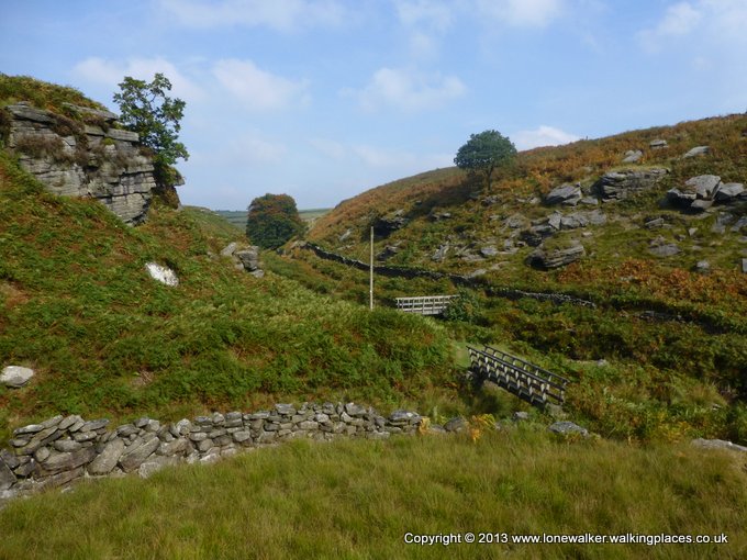
I slogged my way up the incline, taking lots of short breaks and admiring the increasingly impressive views of the valley behind me. There was cloud on all the surrounding tops and at this point I was glad it wasn’t too hot. Not content with just going straight up the side of the hill, the path decided to take a serious dip about half way, dropping down to Hebble Hole (what I thought of as ‘Dingly Dell’), a lovely little secluded area with an ancient stone bridge and a tinkling stream running through it. I stopped for a minute to catch my breath and then slogged up the other side of the slope. The path hereabouts is not great – it’s very muddy, which is not great in combination with steep inclines one of the narrow paths between two walls was almost completely blocked by rubble from a broken wall.

I soon came to a sign for May’s Aladdin’s Cave, and I knew the worst was over. This is possibly the most famous shop on the Pennine Way and an absolute must-stop for all walkers. They are open 365 days a year, 14 hours a day and they sell everything. Literally everything! I stopped for an excellent pint mug of tea, bought a huge sausage roll for lunch and had an excellent chocolate caramel flapjack, all for less than £3 and served by a friendly and chatty young girl. A half dozen locals came and went as I supped my tea and chatted with the shop girl – it’s quite a busy place, despite its seemingly remote location.
Refreshed and refuelled I climbed the final few dozen feet to Mount Pleasant farm, the gateway to Clough Head Hill and the open moorland beyond. The day was warming nicely now and the moor was lovely and dry. Beyond, I dropped down to Graining Water and found a wonderful wild camp spot – a small green patch of grass beside the stream and a great alternative to stopping in Hebden Bridge if you want to get the climb out of the way before the start of the next day. It was too early for me though of course and I set my targets on the next climb of the morning, up to Top Withens.
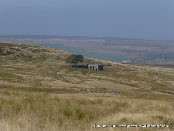
I met quite a few walkers on the path beside the Walshaw Dean reservoirs and was pleased to find new slabs have been laid on the ascent, taking you dry-shod all the way to the ruined farmhouse. I stopped for lunch here and would have boiled a brew if I’d managed to find any water on the way up. But it wasn’t until I left that I found a lovely refreshing spring, just before the ‘Japanese signpost’, where I drank my fill. This really is a lovely section of moorland walking, with a good path through the heather, obviously heavily used, but quiet today.
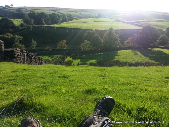
I remember dropping down into Ponden on my last Pennine Way walk and not liking the prospect of losing all that height, only to have to gain it again on the other side of Ponden reservoir and it looked no better today. I was beginning to flag a bit, the day was lovely and warm and I had some time to kill, as I couldn’t pitch too early in my intended spot. I sat beside a wall, half way up Dean Clough, just the other side of the reservoir, facing south west with the warming sun on my face and I could almost feel my batteries recharging as I sat there.
I’ve got my map update skill honed quite well now I think, although it is quite heavy on the batteries on my phone. The screen is on quite a lot as I keep one eye on the map from the guide book and another on the surroundings, checking that waypoints are correct, map features exist on the ground and looking for new guide features that could be added to the maps to improve their accuracy. When I get home I manually mark up the maps with red pen and make any associated notes I need to for the guide book text update.
I climbed the final hill of the day, up onto Ickornshaw Moor, with the sun setting away to my left and the wind rising as I ascended, out of the valley. Ickornshaw is another lovely stretch of moorland, but not at all well suited for wild camping, it being mostly made up of heather, interspersed with huge tussocky grass. I had been expecting this though and although I found a small bare, peaty patch which would serve well at a pinch, I had other ideas for tonight. My first concern was water – I was very low and almost every stream I crossed was dry. I looked for a couple of springs that were identified on the map, but I couldn’t find them.

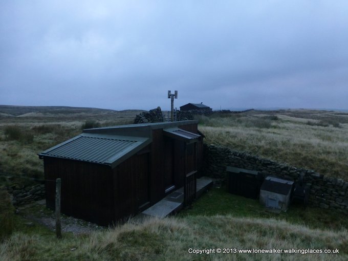
I eventually heard some running water (High End Lowe Spring), right beside an old stone shooting hut. I had hoped to find a flat pitch here but there wasn’t anything suitable and with the wind increasing, I needed some shelter too. I filled my ‘dirty platypus’ with filtered water after walking up and down the stream looking for access. The stream was tiny and running deep in the grassy terrain, so I needed to jump into it to fill my bladder.
I followed the wall at High End Low, away from the stone hut and the other huts (Cowlings) that are scattered on the moor here. These are a throwback to the times when there used to be open shooting rights on the moor and the huts, although still maintained and used regularly are now more like man-caves than shooting huts.

I found a reasonably flat pitch, partially sheltered by a kink in the wall and made camp. I was starving, so I immediately got the stove going and made up one of my dehydrated meals, taking shelter inside the tent from the increasing wind and the falling temperature, now that the sun had set. I managed to upset the stove and spill hot water onto my arm, thankful that it wasn’t actually boiling and made sure I was more careful. After supper I watched a film on my phone, sent some tweets, rang home and had a mostly peaceful night. The wind wasn’t too bad and it wasn’t cold.
I was awake and on the move early next morning and I found my knee was hurting quite badly on the descent into Cowling so I popped an Ibuprofen/Paracetamol cocktail and took my time. The section today, into Gargrave was one of those that just needs to be done – there are few redeeming features to this section, heavily comprised as it is of cow fields, pastures, fences to cross and tarmac lanes. The early part of the morning was spent in a series of short ups and downs, which didn’t help my knee and saw my energy levels drop markedly. I was surprised to find the pub in Lothersdale open, but it was too early to stop, so I plodded on, up the next climb; a steep little sucker onto Elslack Moor, the highlight of the day.


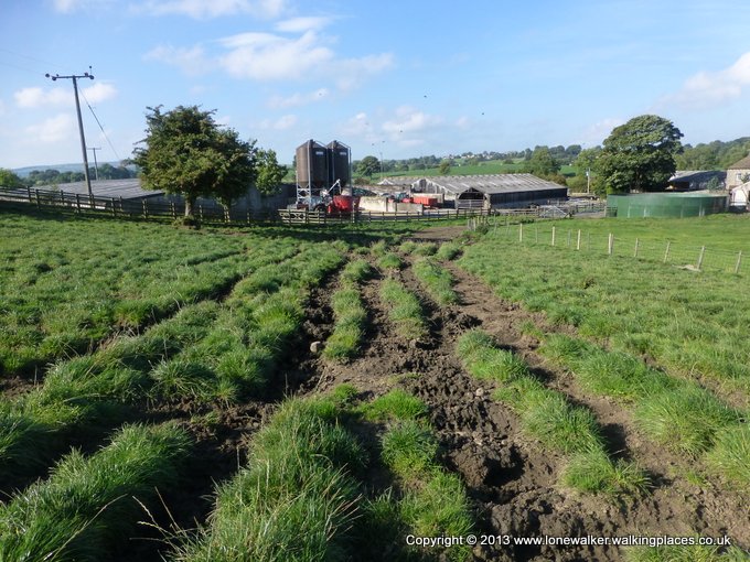
Any moorland would have been appreciated at this point, breaking up the boring string of fields and pastures and Elslack Moor has a trig point, so it was doubly welcome. The stretch beyond was along tarmac though and then through some steeply sloping fields to a very muddy farm, the approach to this ripped and torn by hundreds of cattle, the mud liberally mixed with manure to produce a string of curses from yours truly.
By the time I slogged up another slope into Thornton-in-Craven I was knackered. My pace had slowed to a crawl and I took the chance to sit beneath a fine old elm in the little village, before continuing up the hill beyond. I crossed Langber Hill and promised myself a stop at the pub in East Marton, which I estimated I would arrive at about lunch time. I got there at 11:45 to find the doors locked, staff clearly visible inside, but refusing to open the door, even when I rattled it. It was quite warm now and I was parched – the terrain this morning not lending itself to the collection of water. I had been banking on the pub to supply cold drinks and water.

I found a small café, beside the canal, further down the path and sank onto an outdoor bench for a break. I ate the remains of the flapjacks I’d eaten for breakfast and downed two cold cans of coke before moving on.
The final couple of miles across more fields into Gargrave were just as tedious as the previous few miles and I was glad when I arrived back at my car. All in all it had been an excellent weekend. The weather had been great and I had the satisfaction of having knowing I’d completed one of the dullest sections of the walk.
8 thoughts on “Filling in the Gaps”
Hi, I’ve been reading a lovely book by the poet Simon Armitage called “Walking Home” which is his writing about walking the Pennine Way. It got me googling and came of with this great blog of yours. I am really enjoying it and your photos are wonderful! Thank you, Diane
Great to hear from another fan of the Pennine Way! I will be doing the final section from Hadrian’s Wall to Kirk Yetholm in early Arpil,so be sure to pop back then to close the circle. Do you have plans to walk the path?
Nice pictures 🙂
Some glorious pictures Stuart — bringing back some wonderful memories on some of the best bits of the PW — not all of them sunlit like yours . 🙂 Best Tim
Glad to have evoked some good memories Tim, I’ve had a mixed bag of weather on the PW so far. Last weekend was so awful I actually baled after only an hour or two!
Lovely photos. I wild camped at Top Withins – wasn’t in the least bit spooky 🙂
A decent bit of weather helps with the photos of course 🙂 this walk was a couple of weeks ago now, but hadn’t got round to posting it until today.
I looked into the shelter at Top Withins while I was there, I certainly wouldn’t have spent the night inside it, it looked rank!
I looked into the shelter too – it would have to be a dire emergency for me to sleep in the there! Much nicer in my tent………..