If I’d started this walk today, I would almost certainly either have had to cancel it, or I’d be dead on the summit of Cross Fell, having been blown away by the reported 112 mph winds that were recorded by the weather station located at the radar station on Great Dunn Fell. I consider myself very lucky that I walked it yesterday and today’s walk was mostly low level and fairly sheltered. I still recorded 40mph, which is faster than yesterday’s wind and I can’t imagine what 100 mph winds feel like.
I had an early night last night, after watching Samuel L Jackson in a kilt in the excellent film ’51st State’. I didn’t even hear the wind which apparently battered the cottage all night long and kept the landlady awake all night. I heard it in the morning though, trying to lift the roof off the place and tumbling bits of trees down the street outside. It looked foul. I took my time over breakfast, working on the basis that it couldn’t get any worse and the longer I spent dilly dallying the better it would be when I stepped outside. I was wrong.
I decided to leave about 9:30 and I was about to put my boots on when I looked out the front door. The rain was horizontal, coming from the direction I wanted to go, trees were bending dangerously and the wind was making an incredible noise. Lana, the landlady insisted I wait a little while longer and she made me sit down and she made us both a cup of tea. 30 minutes later, after a good chinwag, the sky had brightened somewhat and the ferocity of the wind had dropped a little. I stepped out into what was still a very windy day.
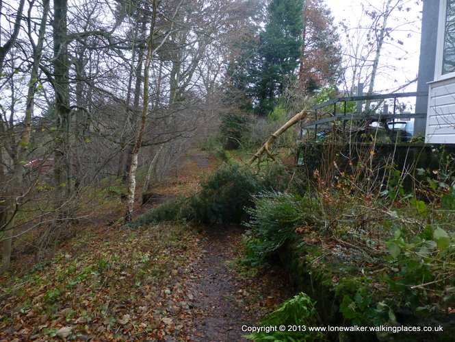
From Garrigill the path follows the River South Tyne for about 4 miles into the village of Alston. It runs beneath trees for much of the way and I was dodging fallen branches all the way, both on the track and falling from the trees onto me! Many of the fields were waterlogged too and my feet were soon swimming and my trousers mud splashed all the way to the thigh. On one exposed section of hillside (the only hill I did all day) my Kestrel recorded 40mph, into my face, thankfully only for a few hundred yards until I dropped back to the river and along paths into Alston.
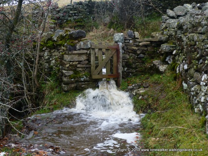
Just before I arrived in the village, I came across a tiny gate beside a stream. The stream had burst it’s banks and the water was pouring through the gate. It was a foot deep at least and I had to scramble up onto the wall and over it, to bypass the gate. I will try and add a photo of it, it was quite impressive.
I timed my arrival in the village perfectly, the Cumberland Hotel opens at 12:00 and I turned up at 12:01 to find the fire already burning nicely and a good selection of real ales on tap. I’d done 4 miles and had another 6 to do, I reckoned I could stop for at least an hour, so I settled in and made use of their WiFi. The landlady was very chatty and we had a good talk about the Pennine Way, about music and various other topics.
I had a lovely pint of ‘Holy Cow’, which seemed an appropriate name given the weather I’d just walked through. Various Twitter friends relayed the information about the wind speed recorded on Great Dunn Fell, knowing that I’d walked it yesterday. I couldn’t believe how lucky I’d been.
The problem with avoiding wind speed like that is judging how fast the wind will be on the summit, from your position on the relatively protected lower slopes. Once you’re into the walk, there comes a point where you think it’s easier to continue than it is to turn back, a reluctance to fail perhaps, or not wanting to give in to the elements, especially if you’re doing a multi day walk and the rest of the walk is dependent on you reaching your intended destination that day. These are the sort of factors that lead to bad decisions and get people into trouble. I’m fairly certain, though, that if I’d been walking in the other direction, and I was walking from Garrigill to Cross Fell, there’s no way on earth I’d have carried on. The conditions in the village this morning were bad, it doesn’t take much imagination or intelligence to know that if you add 2000 feet of height to that, then you’re going to be walking in some dangerous conditions on the top. I just hope no one was up there today.
I left the pub in Alston at about 1:15 and bough some supplies from the Co-op, I needed something for lunch tomorrow as there is nothing on the way. The electric sliding front door of the little shop was jammed half way open (half way shut) and I struggled to get through it with my pack on. They had the heating on full blast to try and counter the cold wind that was blowing in through the hole, it must have been costing them a fortune.
While sitting in the pub, I decided that I was going to take the easy option this afternoon. I could follow the Pennine Way religiously, as it winds it way up and down the hillsides, through fields and pastures, across boggy moorland sections, or I could walk the good firm, level path of the South Tyne Trail, that runs beside the South Tynedale railway. It’s shorter, lower, easier to follow and with the wind still blowing a gale I didn’t fancy the 400 feet additional height that the Pennine Way route gains. I’ll come back another day and do the section again. I needed to map the STT alternative route anyway, it’s a much more sensible path to use than the pedantic rambling of the Pennine Way over this section. The only reason to use the PW path here is so that you can tick the box for your LDWA (long distance walkers association) collectors badge. I imagine that the PW route was the best one available when they were doing the planning 50 years ago, the STT was probably still a working railway, but there needs to be a rethink now. Using the STT also avoids a long section of road, so it’s probably safer in the long run too. The National Trail planners need to review their options here, there is no good reason, as far as I can see, to keep using the old route that runs all round the houses. If you can think of one, please let me know.

I was walking into the wind all afternoon, I slogged along, mapping all the gates and stations along the route, ready for the map updates. I’m hoping that I can add the STT to the guide book update.

I eventually left the good track and joined the road into Knarsdale, knocking on the door of Stone Croft B&B at about 3:30. After having a great breakfast at East View this morning, followed by a sandwich and chips in the pub in Alston, I’m not sure I can be bothered to walk the 200 yards or so to the Kirkstyle Inn. I’m not particularly hungry and it’s bound to bloody rain on me!
I have no phone signal and no WiFi is within range, so that may be the deciding factor. The pub may have WiFi. If this goes out tonight then you can assume I’ve gone to the pub.
5 thoughts on “Garrigill to Knarsdale”
The official PW route from Alston is a waste of time. The old railway for me every time. I stayed on it as long as I could on both my trips.
I second that emotion!
Hello Lone Walker
I like to know if the Stone Crofft B&B still open is. Do you have information and contact?
Best regards
Arthur Stijns
Ps. I will be there on 29 august 2023
Hi Arthur, no I don’t think it’s open any more. The Kirkstyle Inn is your only option in Knarsdale I think, and that’s not cheap!
Stuart, Good to hear you were not at elevation today with all that wind. I can’t think of a compelling reason not to reroute the PW along the South Tyne Trail. The current route isn’t particularly memorable. During my last PW through-hike the local advice in the pub at Alston was to take the STT. Glad we did, as the walking was pleasant and the Lambley Viaduct very photogenic. I vote for the reroute!