2nd May 2013 – St. Johns Town of Dalry to Nether Holm: 14.9 miles, 2,873 feet
“One may walk over the highest mountain, one step at a time” John Wanamaker – “A pioneer of marketing” (1838 – 1922)
Day five has certainly been the pick of the bunch so far. Not only the terrain I passed through, but the views around me absolutely made the day. The weather played it’s part too, the forecast was mostly correct, in that it didn’t rain at all, but it didn’t feel as warm as it suggested it should have done. So today I got into the hills properly, albeit with quite a long walk in.
The Clachan Inn was OK, it felt old and dated and not particularly clean, but the bed was comfortable and the linen was freshly laundered and I slept like a log, that is to say I pretty much died once I settled down. I’ve just started watching Season Two of the Walking Dead and I only managed one episode last night. I think I managed about 9 hours sleep and I was awake just before the alarm went off at 07:30.
I’d asked for an 08:00 breakfast with a view to getting out on the path by 09:00. No point leaving any earlier really, as I couldn’t arrive at the B&B much earlier than 16:00 and with about 15 miles to do I reckoned at a nice slow pace I’d be walking for about 6 or 7 hours.
It’s great to be able to amble all day, especially when there’s quite a lot of uphill work to be done. I never felt under any pressure to get a crack on and I was happy to stop whenever the mood took me, or when I found a convenient rock or sheltered spot out of the chilling wind on the higher tops.
The difference between the relaxed pace today and the somewhat rushed schedule of yesterday was startling. Not only do I feel much fresher this evening, when I’m writing this, but I feel more relaxed in myself.

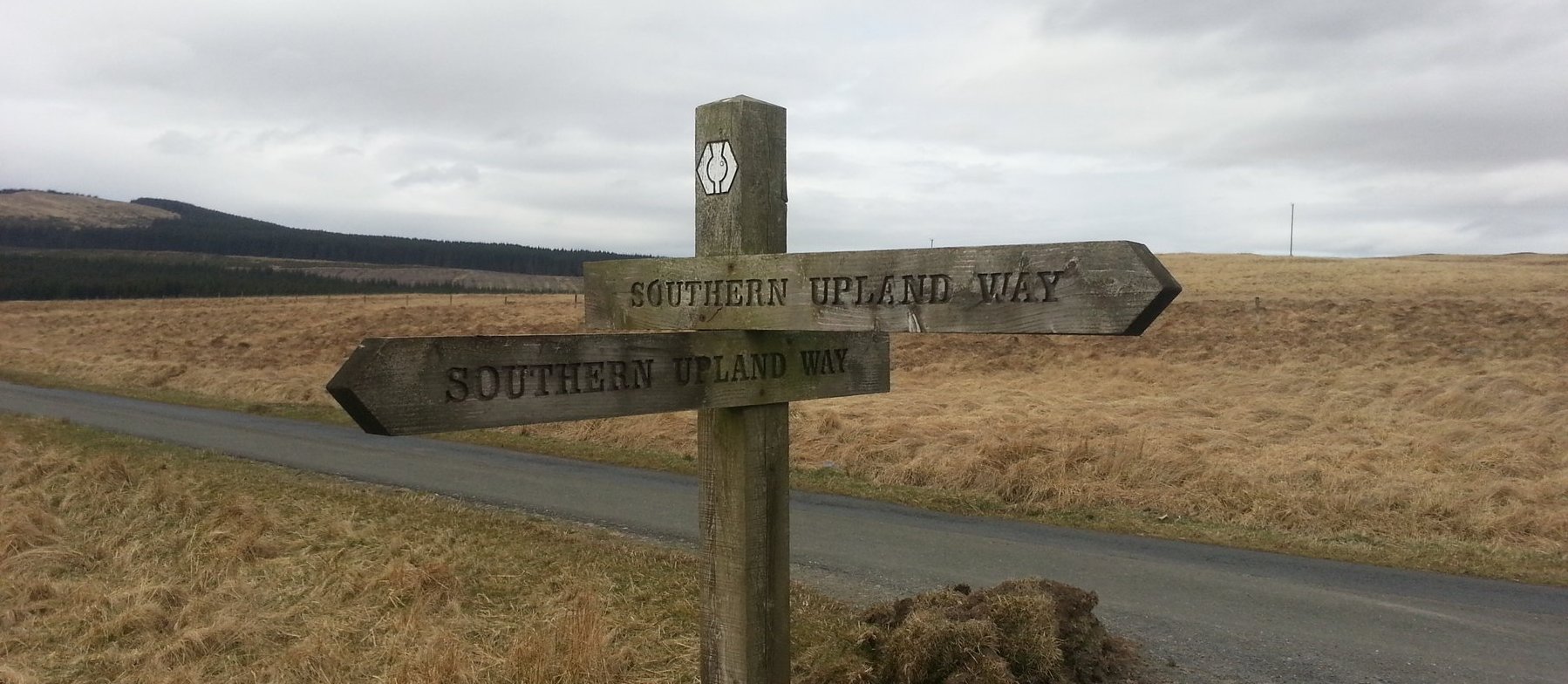
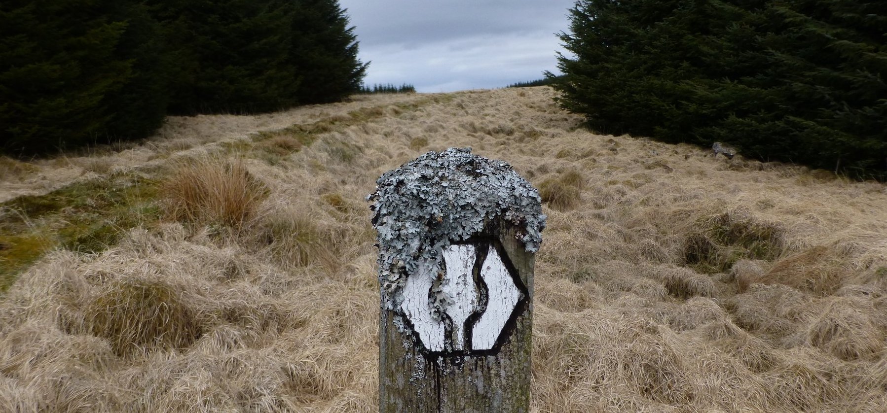
I walked up the road out of Dalry (pronounced Dalrigh) and almost immediately it was off the tarmac and into fields and wide, rough pastures. There were plenty of boggy sections, but the path was always fairly clear and doesn’t have the arbitrary feeling it had a couple of days ago when the way markers just pointed me across an expanse of moorland and expected me to make my own path. The path today felt like something I’d be using in the Howgills or on the higher fells in the Dales. It was clear, but boggy in sections.
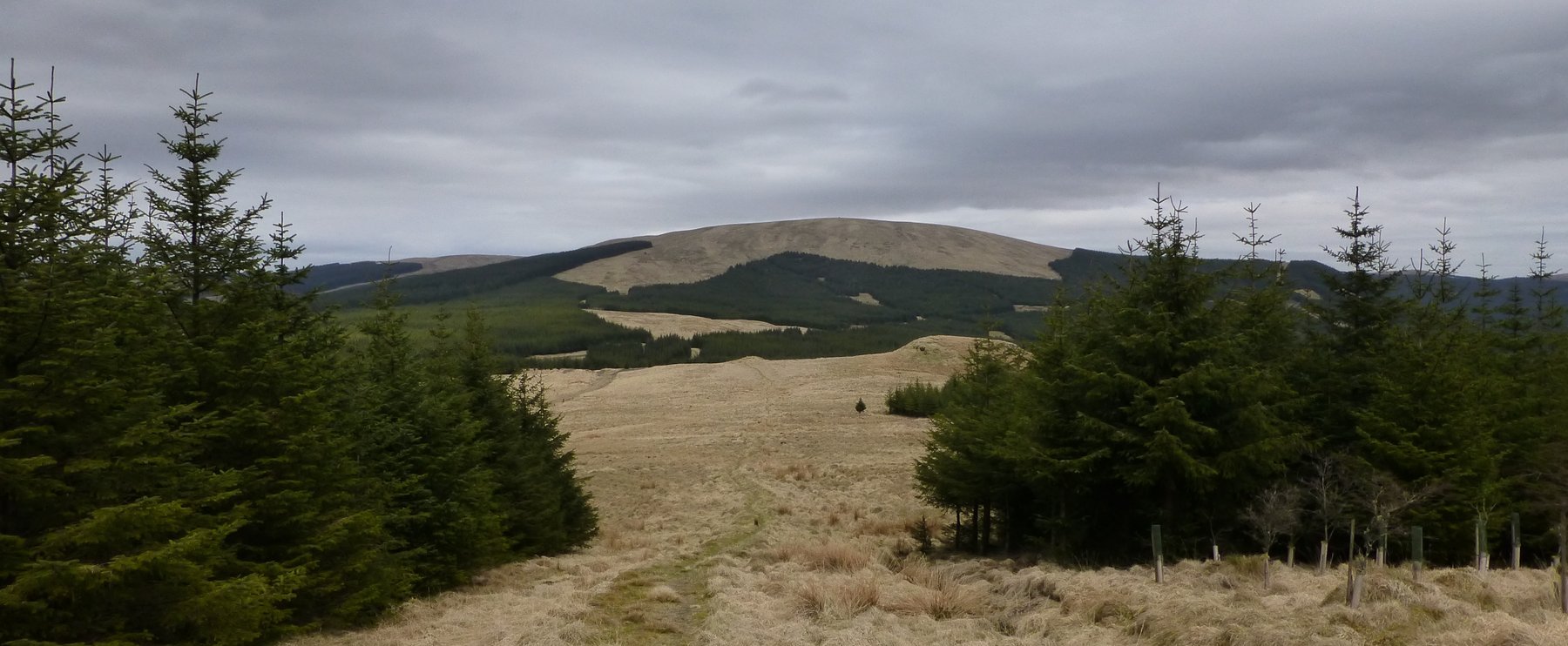
The rolling hills surrounding me were all brown, without exception, even the lower hills I was walking across were universally brown and drab, no green flush to the grass yet. Dead bracken was evident too, without any sign of the green shoots pushing through yet. It looks like the snow that lay across these hills until just a couple of weeks ago has delayed any signs of spring. There were still white patches visible on many of the surrounding hillsides, despite the warmer weather we’ve been having recently.
As well as being immensely impressed with the quality of the way marking on the route, I’m also pleased to find that most field boundaries are crossed using gates, rather than stiles. The gates all seem to be the same, and I get the impression that they’re provided by the National Trail to landowners, their uniformity is so striking. They all have a little gate set into a much bigger gate, so you can step through the small one if you’re a walker and open the big one if you need to drive through. I missed them today though, as the track follows mostly footpaths and not roads or farm tracks, so the boundaries are crossed by typical two-step wooden stiles. I tend to find this becomes harder as the day progresses and my knees become less flexible and negotiating stiles becomes a chore.
A couple of miles outside Dalry, just after Ardoch Hill, the path uses a thin track between the Earlstoun Burn and a boundary wall. I forced a herd of sheep ahead of me, which seem to be trapped in this section between burn and wall. They churned up the path to a right mess and I was soon cursing them as I waded through the mud and mess they’d created. There was no way my boots were going to be dry at the end of the day though, so I just ploughed through it.
A short section of tarmac was endured just beyond this and I even managed to walk on the verge, so I can almost say I’ve had a tarmac free day….. almost.
Leaving the tarmac I began what felt like a 7 or 8 mile ascent. First up the gentle slopes of Marskaig Hill and then Culmark Hill, followed by a little respite as I dropped down to Stroanpatrick and the minor road that the Way uses for a few dozen yards.
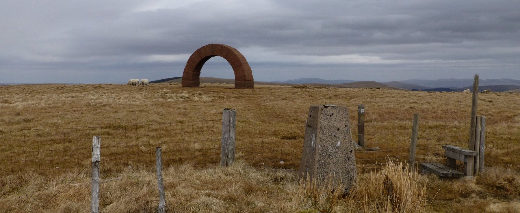
I’d been able to see Benbrack for a while at this point and I could just make out the stone arch that has been built on it. Well, in actuality I took a full zoom photo of the summit from a distance of about 6 miles and then viewed that on the camera screen. At 20x zoom, I could make out that the tiny black mark on the summit was indeed the Striding Arch, a sandstone construction that is also mimicked on two other nearby hills.
Before I got close to Benbrack though I had some more climbing to do. I lost the path for a while, just beyond Stroanpatrick. I think sheep have been using them for back scratching or perhaps they’ve been felled by wind or weather, but a number of fallen marker posts, and me concentrating on my audio book instead of watching the map, meant I strayed away from the path. I cut across an array of lumps and bumps at Kiln Knowe to meet it again, climbing towards a gap in the forest ahead and the wild path up to Manquhill Hill. I got some lovely views from this bald top, with forest stretching away on most sides but a clear view of the path ahead to Benbrack.
That particular climb seemed endless. It was 12 miles into the day and the wind was picking up, the temperature had dropped and I was beginning to flag a bit, so it was probably not as bad as I recall. I took a couple of gasping stops as I climbed and eventually I could see the arch and then the trig point at the summit.

I’d sort of convinced myself that Benbrack was the end of the climbing for the day, so was quite surprised to find that I still had some more to do before I could drop down to my B&B. It was all quite soggy from this point too. Very reminiscent of a Peak District summit. I dropped down, then up to Mid Hill, then the same again to Cairn Hill. I said goodbye to the Southern Upland Way at this point and turned left towards Coranbae Hill, involving another down and up and from here I descended a thousand feet over the next mile or so, following a fence line beside the forest on my left.

Towards the bottom, the path got very wet and quite tricky in places as it struggled to stay above a deep, rocky burn called Altry Burn. I reached the bottom and looked for a place to cross the fast flowing river. I was lucky it wasn’t in spate, or I’d never have managed to make the crossing, but I eventually found a series of stones, dry enough to enable me to hop across. It was here that I saw my first people of the walk.
I don’t think I’ve mentioned how few people I’ve seen since I started this walk. I don’t mean other Southern Upland Wayers, I mean other people full stop. In the towns of course I’ve seen folk, but once I leave the environs of a village that tends to be it. Yesterday I saw three lads in a Land Rover and a couple of lorry drivers on the logging road, but I’ve still not seen another walker on the hills, not even from a distance. Even when walking somewhere ‘unpopular’ like the Howgills, I may not meet another walker, but I generally see one from a distance. Not here. I’ve not seen a soul. Until this afternoon, walking past Holm of Dalquhairn Bridge, when I saw four mountain bikers. They were too far off to speak to and they weren’t walkers, but it’s nice to know other people do use these hills.

I walked down the long tarmac drive to Nether Holm of Dalquhairn and rang their bell. Which is a bell, a big brass ships bell, with a clanger and everything. The tolling of the bell summoned a lady to the door, who looked surprised to see me. ‘Am I in the right place?’ I asked. There had been no B&B sign on the drive, I’d just followed the directions provided. ‘I’m looking for Susie’ I explained. ‘Oh, gosh, I wasn’t expecting you today’ she said. My heart sank.
Fortunately she had enough room to accommodate at least 15-20 people, in a separate building behind the farmhouse. It was cold and basic, feeling a bit like a youth hostel or bunkhouse. There was a central lounge with a small kitchenette, wood burner which also heated the hot water and several bedrooms and bathrooms. I got a bed and a choice of shower or bath.
The wood burner took an age to heat the water though and in the end I gave up waiting and had what could generously be called a tepid shower. I didn’t linger long under the weak stream of cool water and was soon back with my feet in front of the wood burner.

There was an impressive amount of religious iconography about the place. Every wall had a picture of a saint, the Pope (the previous one) or Jesus. I began to think this may be used as a retreat. Being so far from any other facilities, the room included an evening meal and I was asked to come across to the house at 19:00 for supper. I spent some time updating the journal. As expected, there was no phone signal and no WiFi either, so no chance to upload what I was writing. I sat and fed the wood burner, and I’m sure my clothes will smell of smoke for the rest of this journey, but I do enjoy the smell of wood smoke and it may overpower the other smells my clothes tend to build up on a long walk.
Supper was very nice, provided with a bottle of Jennings Cocker Hoop, so someone had good taste in beer. After I’d eaten and chatted I headed back across the yard to my empty hostel.
The weather for tomorrow looks a bit grim, it’s due to rain all day and if that proves to be the case then I’ll probably take the low route along the Lorg Trail and through the forest to rejoin the path, rather than climb the 1000 feet back to the path at the top of Coranbea Hill. This will also shave a mile or two off the route, thus saving me a couple of hours perhaps. I’ll see what the weather looks like in the morning before making a decision, but I don’t see any value in climbing all that way into the cloud. Unfortunately it seems like the low route through the forest is renowned for being a bit wet and boggy, but I have my carrier bag gaiters for just such an emergency.
2 thoughts on “Southern Upland Way 2013 – Day 5”
How lucky you were to find this place! Nether Holm of Dalquhairn is well known to me. Every year myself & few friends hold a Burns Supper in the bothy where you stayed for the night. We are now on our 25th anniversary of staying here.
You are right – Susie & Peter use this as a religious retreat. What a great place to explore the many hills in the area. Not many folk know about this gem…………
Must be a great place when it’s full of friends, it wasn’t bad on my own! I particularly liked the hairdressing book I found on the shelf – make me chuckle. Have a great Burns Night!